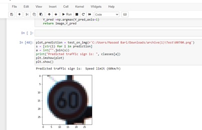
Traffic Sign Type Detection Using OpenCNN And TensorFlow(AI)
By Using tensorflow library in jupyter notebook I detect the traffic sign type from images and find their type using machine learning.
Read More


Senior GIS Analyst with 7 years of work experience in Road Asset Management, Pavement Analysis, Electric Utility Network Management, Enterprise GIS Administrator, Basemap Development through GIS. I have the expertise of Enterprise Geodatabase Management System, ArcSDE, ArcGIS Server, ArcGIS Pro, Collector for ArcGIS, Microsoft Excel, Oracle database Administrator, Python Scripting, and SQL queries. I have worked on integrated GIS projects for clients such as Al Dhafra Municipality, Al- Ain Municipality, Abu-Dhabi Municipality, K-Electric Pvt. Ltd., and RTA Dubai(Road Transport Authority). I have proficiency in ArcGIS, Autocad, QGIS,Python, Structural Query Language. I have the expertise of publishing services for ArcGIS Server and Qgis Geoserver and database installation of Postgre SQL with enterprise gdb and multi-user editing environment.
know moreJan 2019 - Present
May 2017 - Dec 2018
Nov 2015 - December 2016
2014
University Of Karachi
2013
University Of Karachi
2010
Government College Forman, Pre Engineering
2008
S.M Public Academy, Computer Science

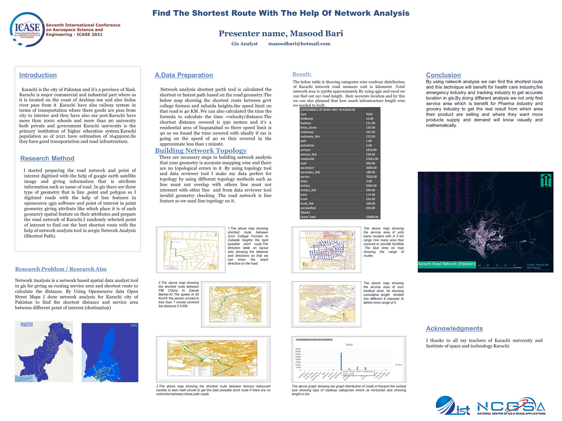
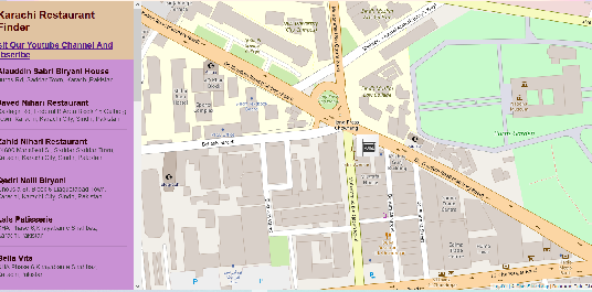
Finding the closest route and service area with the help of network analysis & web application with the help of Arcgisapi for Java script And Leaflet(Opensource).
Automatic Traffic Sign type detection with the help of Machine Learning.Sql Queries Handling Database Backup And Creation.
Lorem ipsum dolor sit amet, consectetur adipisicing elit, sed do eiusmod tempor incididunt ut labore et dolore magna aliqua.

A Geographic Information System (GIS) is a computer system that analyzes and displays geographically referenced information. It uses data that is attached to a unique location. WebGIS is an advanced form of Geographic Information Systems available on web platforms. It kicked off as a GIS running in web browsers and has evolved into Web GIS serving desktop and mobile clients. A spatial database is a database that is enhanced to store and access spatial data or data that defines a geometric space. These data are often associated with geographic locations and features, or constructed features like cities.

SQL(Structual Query Language) is a query language for both spatial mapping and attributes By using operators "like" "=","And","OR" we can detect the records from it Using different join methods we can join different tables with the help of primary or foreign key.
In Gis you have different tools and model builder and python scripting. In Webgis you have javascripting,css,html,python languages by which you can make your own spatial mapping device and web app.The examples are Leaflet,Geoserver,Arcgisserver. Database such as Oracle,Sqlserver,Posgress and software like Qgis,Arcgispro you can do your spatial mapping in it.


By Using tensorflow library in jupyter notebook I detect the traffic sign type from images and find their type using machine learning.
Read More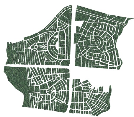
By using spatial mapping you can digitized the shapes in line point polygon and in backend you can get your attributes data linked location wise.
Read More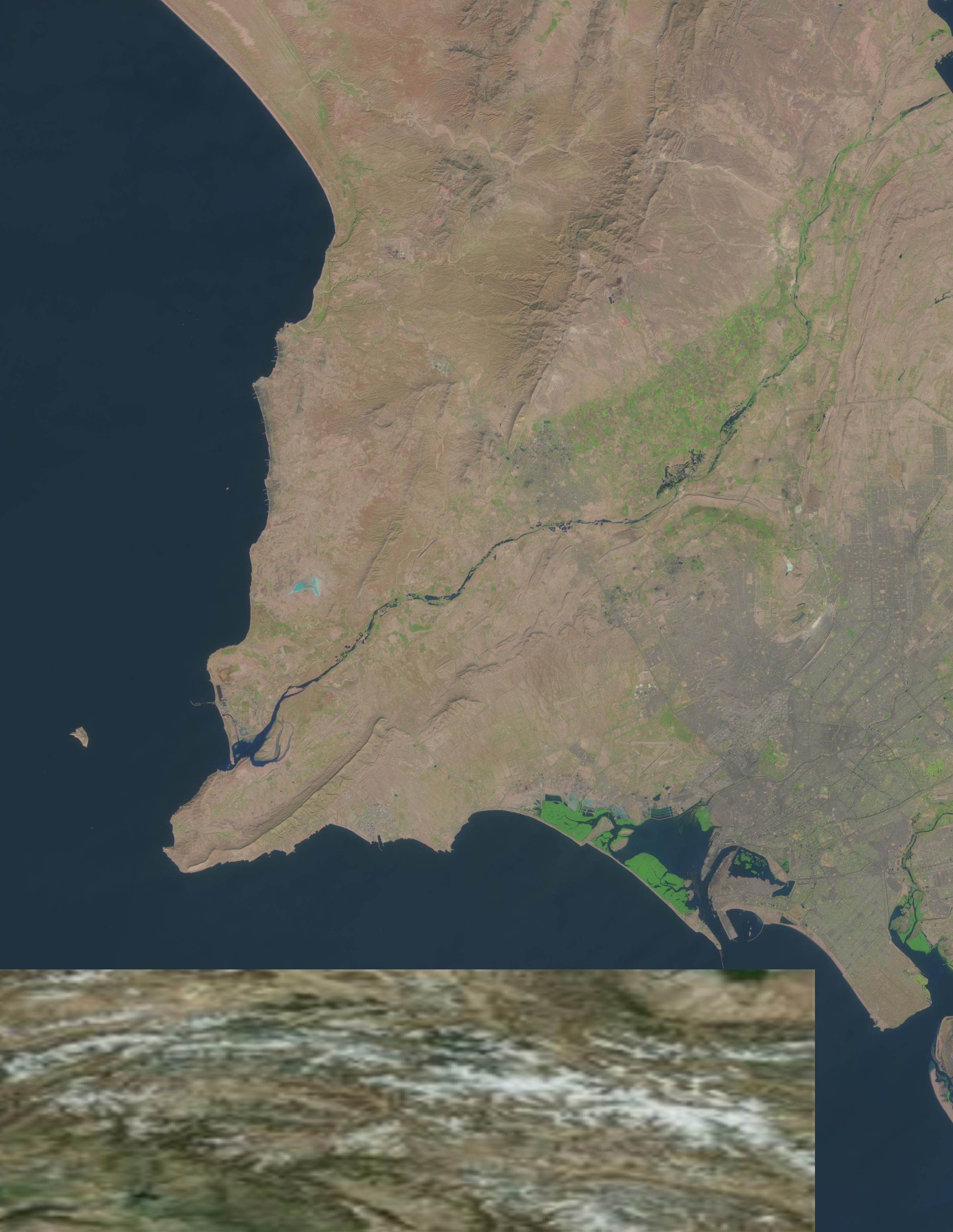
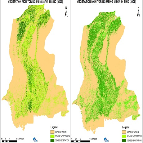
By Using Remote sensing you can done image analysis and classification and deep learning with the help of satellite image.
Read More