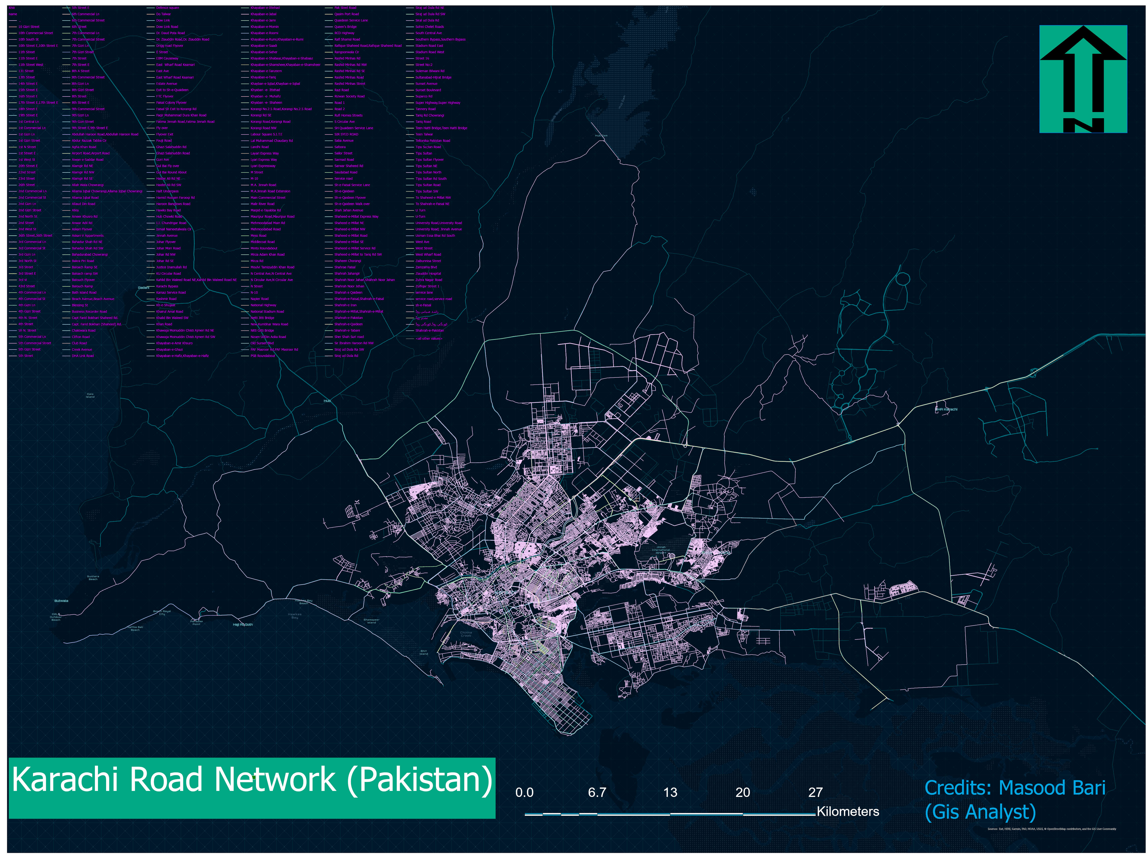
Network Analysis Of Karachi City In Gis
Road Network Analysis with the help of network analysis tool and spatial mapping of roads in karachi their attributes and information about roads.
Read More


Road Network Analysis with the help of network analysis tool and spatial mapping of roads in karachi their attributes and information about roads.
Read More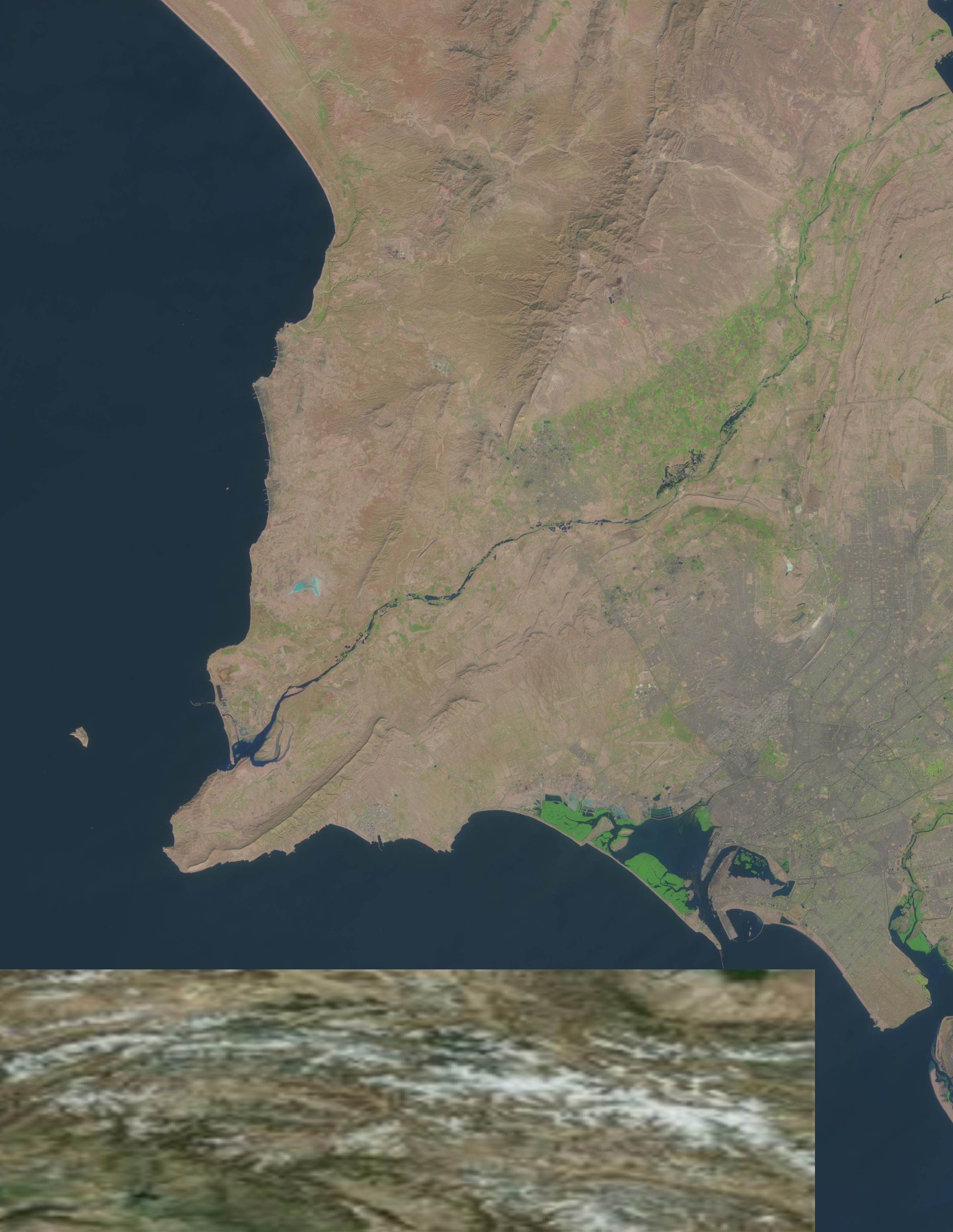
MSAVI AND SAVI Drought Monitoring Using Remote Sensing in the region Sindh Pakistan
Read More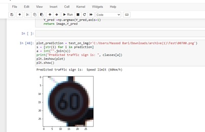
USING IMAGES I MADE A MODEL OF TRAFFIC SIGN PREDICTION WHICH THEY PREDICT WHICH TYPE OF TRAFFIC SIGN IT IS FOR EXAMPLE IS IT STOPSIGN OR GIVEWAY ETC.
Read More
IN GIS YOU DIGITIZED THE SPATIAL MAPS AND CONNECT TO THEM WITH DATABASE BIG DATA AND LINKED DIFFERENT ATTRIBUTES AND VISUALIZE THE DATA.
Read More
USING GIS TOOLS YOU CAN FIND THE SHORTEST ROUTE AND SERVICE AREA OF DIFFERENT DESTINATION.
Read More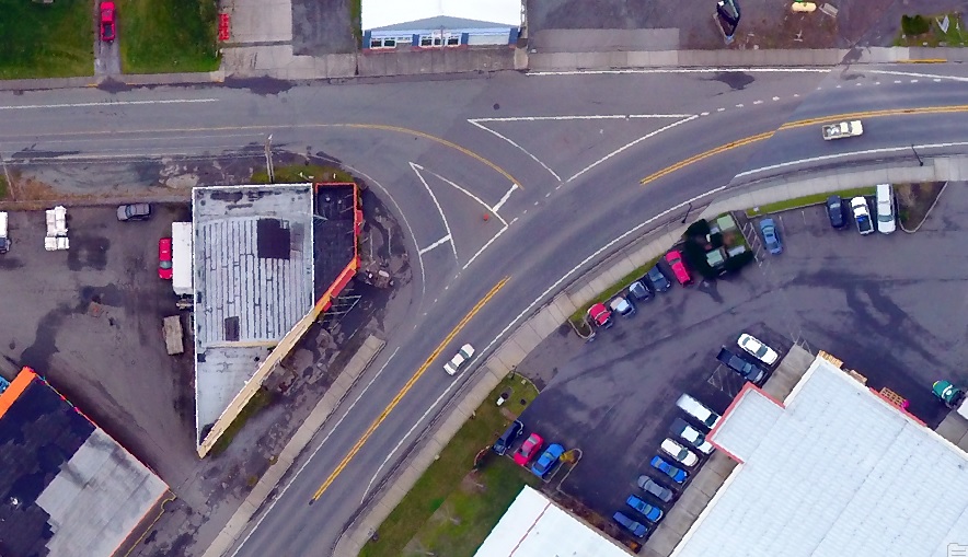
With Gis You can Do 3d measurement and Image analysis by using 3d data of lidar data and find their z-values(elevation).
Read More